Intel drone software promises to unlock potential of aerial data
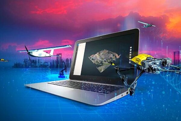
The Intel Insight Platform is a cloud-based digital asset management system that enables customers to store, share, and manage data that commercial drone systems collect. The platform can use the aerial data to generate 2D and 3D models, take measurements, enable sharing and collaboration across teams, and run data analytics.
Along with the Intel Insight Platform announcement, the company also demonstrated its Intel Mission Control next-generation flight planning software, and new updates for its Falcon 8+ system. The latter include additional payloads for greater data capture, as well as distance hold and distance guard – both obstacle avoidance features.
“We are pleased to announce a suite of new Intel drone technology,” says Anil Nanduri, vice president and general manager, Intel drone team. “Now companies can come to one supplier, and a name they know and trust, for their hardware and software needs – providing them with more tools to capture critical information about their assets, process and analyze it, and make insightful decisions for their business.”
Currently in beta testing with customers, Intel Mission Control software is designed to increase workflow efficiency and enhance automation of drone flights for commercial missions. It enables Intel Falcon 8+ drone operators to create 2D and 3D flight plans for commercial surveying, mapping, and inspection missions.
Flight planning is automated with advanced preset mapping modes, and multiple layers of airspace information are integrated to support flight safety and compliance. It also features automatic pre-flight safety and system checks. After a mission is completed, the software provides a quick preview of the collected data so the UAV operator can check and verify for adequate area coverage and overlap and even inspect the quality of individual images in a 3D format.
Three new Falcon 8+ payloads are designed for inspection, surveying and mapping applications:
- The Intel High Resolution Imaging Payload captures 42MP images and is based on the full-frame Sony RX1R II camera and generates highly detailed inspection data. This payload also supports RTK through a future software upgrade.
- The Intel Imaging Payload supports obstacle-avoidance capabilities to help enable safer missions and features the 20MP Sony UMC-R10C camera. It delivers real color, time-stamped, and geo-referenced images for mapping, surveying, and inspection.
- The Intel Dual Imaging Payload offers the same features as the Intel Imaging Payload, but has two cameras mounted on one gimbal for simultaneous RGB image capture and thermal imaging.
The Intel Insight Platform is currently deployed to strategic enterprise customers across several verticals, the company says. The Intel Imaging Payload along with the Intel High Resolution Imaging Payload will both be available later this quarter, while the Intel Dual Imaging Payload will be available next quarter.
Related articles:
Verizon acquires drone operations manager for IoT portfolio
Sensors for drones, robots to boom over next 5 years, says report
Drone ID market to be fueled by security, defense
Drone-captured 3D maps promise improved wireless networks
Applying V2X technology to drones
 If you enjoyed this article, you will like the following ones: don't miss them by subscribing to :